
The fun part is that North Korea filed a flight advisory with the International Civil Aviation Organization, which you can see here. It even includes a map identifying "danger areas." Although the advisory doesn't specify what's so dangerous about the "danger areas," a test of rocketry could mean a few things: 1) they're places where booster stages might be falling, 2) "ditch" areas in case there's an accident and they need to drop it somewhere, and/or 3) along the same lines, "target" areas where they intend the rocket to come down.
Keeping in mind that the launch site -- Musudan-ri -- is located by the top-left corner of "F" in "FIR PYONGANG ZKKP" -- is there anything we can discern by looking at these images?
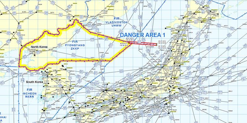
Closeup of "Danger Area 1"
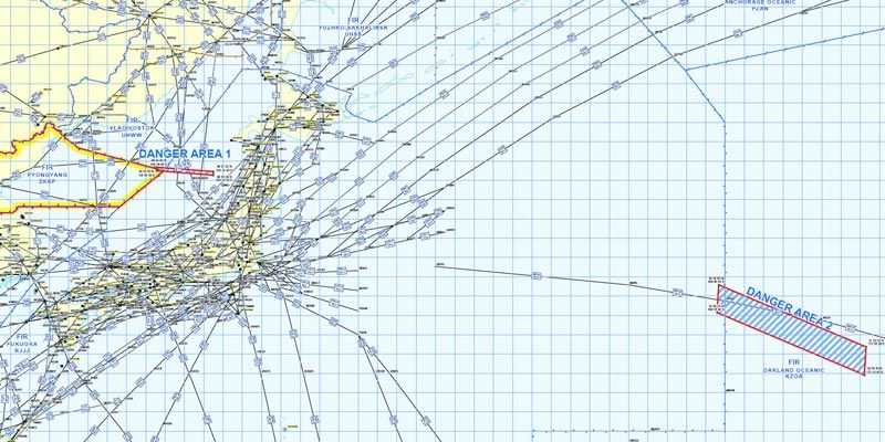
Wideview, with both "Danger Areas."
It's bad enough that North Korea is shooting this rocket over Japan -- just north of the Kanto area, the most heavily populated -- but if you draw a line on those zones, you're headed for...
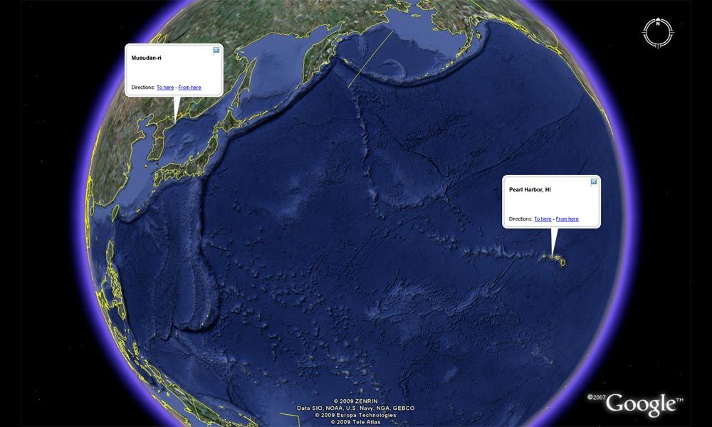
Pearl Harbor.
Dear Leader, THIS is why you're so "ronery."


0 ramblings:
Post a Comment